
After 25 miles south west to Lauder on Saturday, i drove 25 miles south east to Coldingham in Berwickshire on Sunday. Berwickshire is full of old roads, some old tarmac, some gravel, some dirt and grass.
I have a 15 year old Ordnance Survey Landranger sheet no 67 and you can see just how much off road cycling there is on these old roads...

Today i had a loop from Coldingham planned, an estimated 50 miles, but would later in the day be a couple of miles shorter due to some lanes so overgrown with mid summer vegetation growth...

From Coldingham i rode several lanes which were easy gravel, then a lovely old sunken green road lined with Hawthorn to Whitfield which i took a few pics on...


West from Whitfield on a bumpy narrow road, i have spectated here at the annual Jim Clark Memorial Rally which was cancelled this year during the event after 3 spectators sadly lost their lives after a car left the road...

Gravel grinding? :)...

Just a mile or so then do a near 180 and ride west on an old road locally known as `Lovers Lane`,
2 miles or so of metalled surface uphill to Cairncross farm...

Ideal riding for the Genesis these old roads...

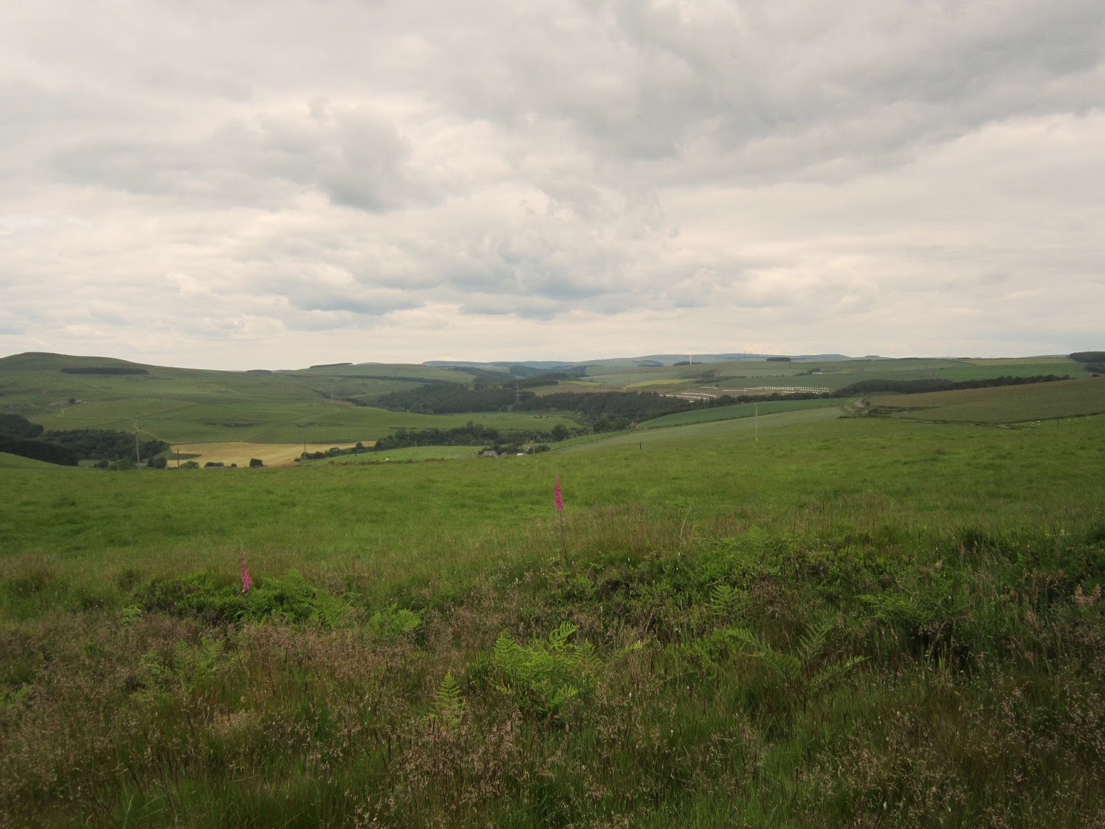
The next lane was only a half Km on the map once back on tarmac, marked as `Gallow`s Law` on the map.
it is centre picture on the horizon. I wonder who was hanged here on this hill many years ago?...

This is a lovely old road, meandering up and down and superb views south as the road climbs...


Bridleway south to the farm below, view across to Reston village was superb...


Through the farm and i wanted to retry riding a a route north to Huxton, here it is marked on my map...

I tried years ago (on a motorbike) to ride this old route which just disappeared. It was the same again. ploughed up though i did ride up a tram line this time but could not see a way through the gorse. Sometimes roads have no use anymore and due to lack of use get ploughed up or grow over with vegetation , in this case Gorse which does not take many years to cover an area totally, then changing the view forever...

Same again here...

I rode back down after i could not see any way through the gorse...


Not to matter as not on the planned loop, but as passing i wanted to have a look. Round a loop of Gravel lanes and across the busy A1...


And up hill by road to Auchencrow village to ride another lovely old green lane... It had been strimmed recently but was a lot softer and slower to ride than when i have previously cycled here. Francis often walks another horse alongside the one she is riding. This woman i pulled in to allow pass safely was walking two!, albeit smaller ponies...


2 km on the road passing Lintlaw farm and the old kirk road to Bunkle Church...

This is the only Right of Way sign i have seen with it`s distance in meters!...


Back on the road for a short burst and up hill to Marygoldhill Plantation where there used to be a great section of single track, sadly riding here last year it was ripped up with quad ruts, water logged and near unrideable. the start looked like it had disappeared so after a nibble in the cooler breeze here i rode up this track, then after a hike-a-bike through ferns emerged onto some of the original track still being ridden by local horse rider by the looks of things, not much to report except it was near unrideable on the cx bike with the stalling stutter bumps from hoof marks and roots- how did this once buff sweet single track become like this?, oh well i was soon through it and emerged down onto the main road and glad to catch the cooling breeze...


Good views at least!...
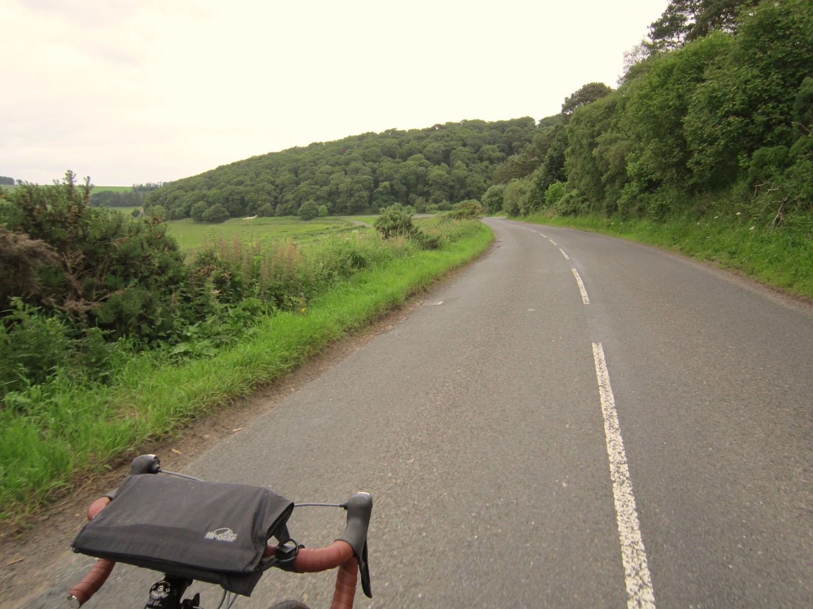
Down the road at 25mph was nice and cool, after sweating through the woods...
Here is the next trail i had planned to ride...

On the map this would be a good 3- miles loop back to Grantshouse...

But it was totally overgrown, so i continued by road to Grantshouse...


From Grantshouse it was north on a signed track to Old Cambus,


Tractor tyre rutted hard pack mud is not much fun on 60 psi cyclocross tyres!, was a jarring ride across here...

Again it was a track which just petered out in fields-though this time grazing fields....

The route was signed around the field but look at the thistles!...

Again i took to the tram lines, thanking this field was not oilseed rape or i would have had to do more of a detour...

Nice views west to East Lothian...

I used the map to follow it but had no luck finding the route on the ground here and veering NE instead of NW towards Old Cambus i aimed for a trig point on top of the far green hill.


Were here on the map in the corner of the wood, but should be about a 1/4 km west...

Hike a bike up here through the gorse...

Must be the least visited trig point in Berwickshire!, nice views though!, and i dropped down to the Moor road east of Old Cambus to continue...


Time for another detour from the usual advertised cycling routes. Been here a few times and no worries about the route!... :)


From Dowlaw farm the coastal trail is now signed...

Two routes, along the cliff tops- second highest cliffs on the UK east coast, to St Abbs, and a shorter old road across to Lumsdaine Farm...


Great coastal views....


This old Threshing machine always brings a smile to me...


You can read more about Threshing machines and their inventor that came from East Lothian in an earlier blog post Here...


The route splits here for the cliff top trail to St Abbs, sketchy offset trails and single track if your not feared of heights. Here is a film of the seabirds at Heathery Carr...
And here is a film from a few years ago cycling to St Abbs...
Today i headed inland...

Up to Lumsdaine Farm and past a private road to a house, now an extended bungalow...

This was once a smaller Bungalow which was a disguised guard house for a Cold War RSG (Regional Seat Government) CHEL R2 ROTOR bunker which is still there under the building. Sealed off from the house today it was a single level facility,
Website link
Canmore link
There is a radar and ROC post (monitoring bunker) nearby; St Abbs ROC Post
Cruising along downwind on a country road soaking up views out across the coastline... sweet...


Down to Coldingham and a trail through the village was fun...

And an old road led to another sweet bit of single track to the coast...


Back to the village and another lovely trail...

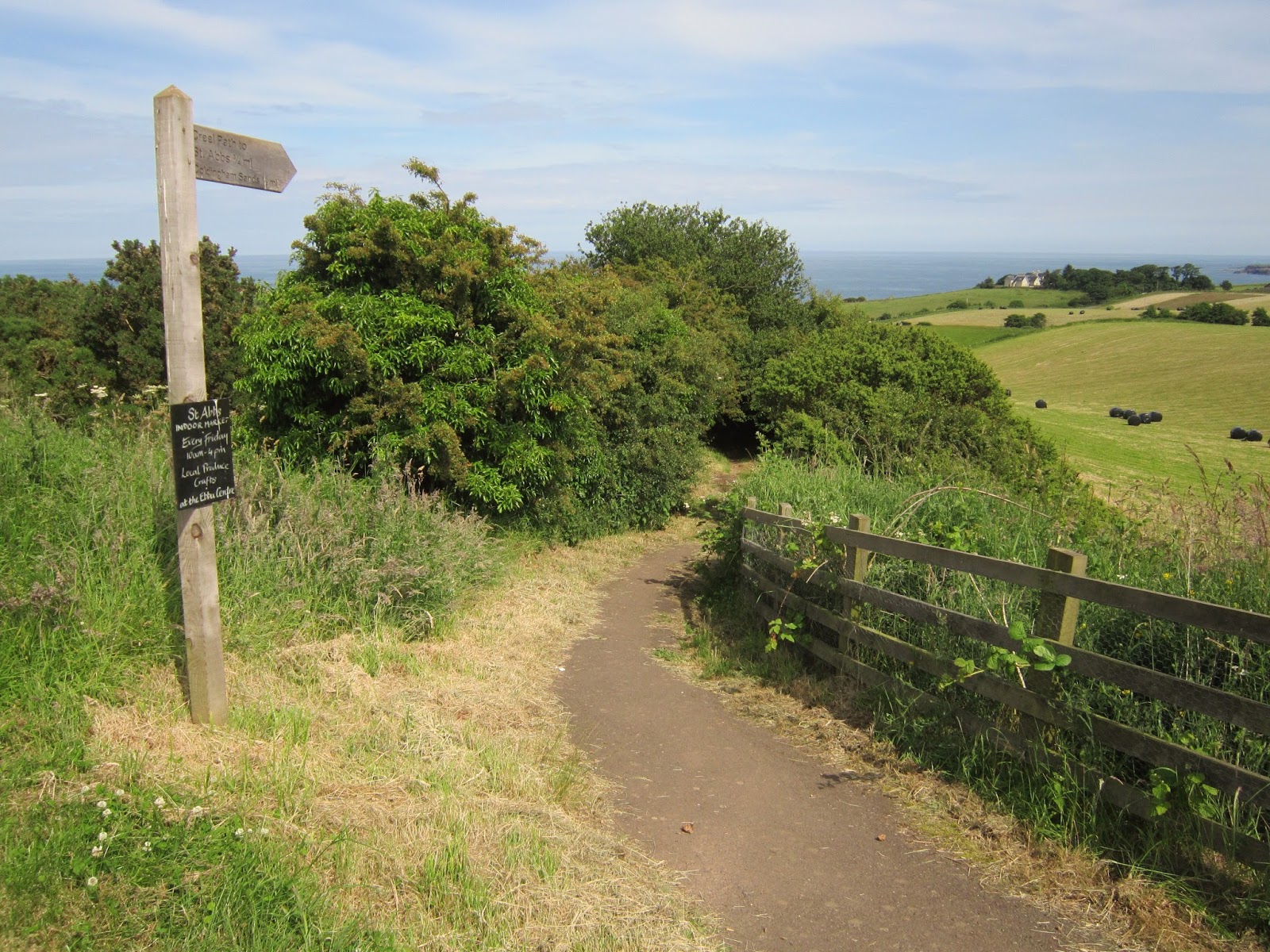
The creel path to the harbour...


Here is a film cycling here a few year back, in 4;3 Standard Definition shot with the Tachyon Xc helmet camera. at 2 minutes is the 3rd lane i rode today in reverse...
Need to return and make an HD film one summer evening here of the other trails i found and rode,
After a couple of loops of the trails it was down to the harbour...


And that's a wrap. A fun 46 miles of Berwickshire...
more soon...


Brilliant route, I tried to follow it on my map but lost it a few times, but that's what it's all about.
ReplyDeleteHi Ped, was a tough 40 miler with the heat and all
ReplyDelete